COPMOBA Epic TRAILS
Casey Sande

Casey Sande
Our chapters hold a variety of world-class bike routes. Find ride information on a few of our favorites below.
Lunch Loops by Joey Early
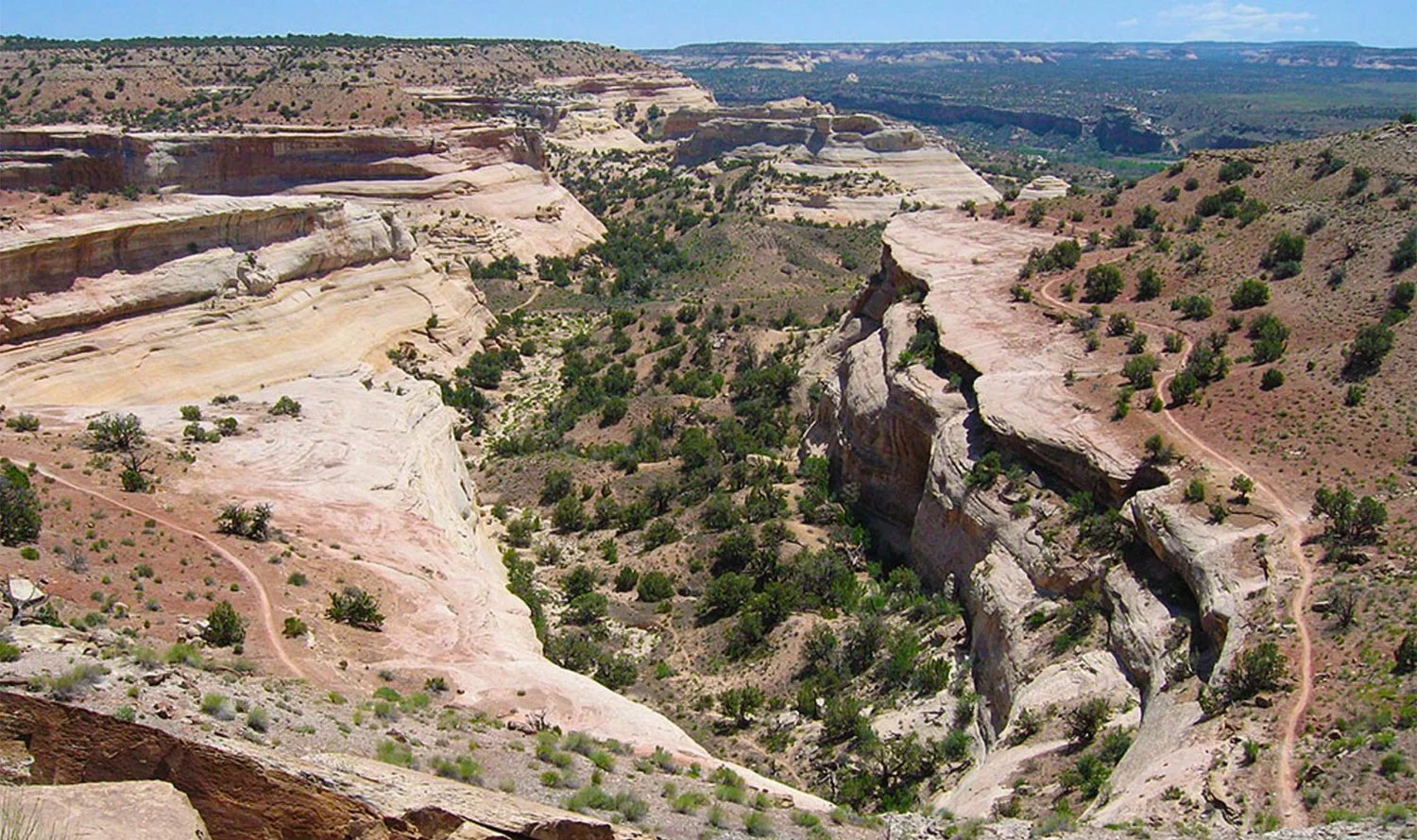
The Tabeguache Trail is a historic route connecting Grand Junction and Montrose. It comprises several motorized and non-motorized sections and all of them, with the exception of the section within the Lunch Loops, are motorized 4x4 trail/road. Combined, the sections create one third of the Grand Loop bikepacking adventure route (Kokopelli, Paradox, Tabeguache) and is a compelling bikepacking route in western Colorado.
Number in parenthesis indicates Forest Service trail or road number
1] Dry Creek Section – 13.5 Miles
(Shavano Valley to Transfer Road)
Rating: Moderately Difficult
To get to the Shavano Valley Trailhead, drive 6.0 miles west of Montrose on Spring Creek Rd. Turn right at 58.75 Rd. and continue 2 + miles to Kiowa Rd. Turn left and cross the valley to Shavano Valley Rd. The Tabeguache Trail begins as a jeep road near the north end of the Shavano Rd. Initially the trail follows the Dry Creek Rim Rd as it steadily climbs for 3 miles. Turn right, go through a gate then ride down into Dry Creek Canyon. At mile 4.1 bear left to cross a small arroyo then bear left again to access the Dry Creek Bridge. After crossing the bridge turn left on the two track, and start to climb. At mile 5.3 take the right fork and follow a two track into a narrowing canyon. At mile 7.0 the two track gets steep and rocky. Continue on two track bearing right as it approaches canyon rim. Once on Cushman Mesa follow two track, and at mile 8.0 turn left and begin a gentle ascent up Cushman Mesa.
At mile 9.0 bear right – be sure to close the gate at mile 9.2. The trail passes through a long meadow dotted with pine trees between mile 10 and 11. At mile 11.0 pass through another gate and bear right. Between miles 8 and 11 notice the gradual change from pinyon pine, Utah juniper, serviceberry to scrub oak and ponderosa pine. The trail winds through a stand of ponderosa pine, and bears right at several inconspicuous forks. At mile 11.7 pass through another gate which marks the BLM/USFS common boundary. The trail continues as an ATV trail (255) until it intersects a singletrack at mile 12.3 that drops into Cushman Creek, climbs out to the west rim, and then merges with a jeep road (508.3E) at mile 12.6. Turn right then bear left at the next 3 forks. The trail intersects Transfer Rd (508) at mile 13.5
2] Transfer Road Section – 7.2 Miles
(Follows Transfer Road)
Rating: Moderate
This section begins as the trail merges with the Transfer Road. At mile 14.5 views of the wild and rugged Roubideau Canyon dominate the trail-side scenery. Scenic vistas of the Grand Mesa, West Elk Mountains and the Black Canyon of the Gunnison are evident to the north and northeast as the rider ascends on the Transfer Rd. At mile 20.7 turn right onto an ATV trail (140) that parallels the power lines.
3] Pool Creek Section – 7.2 Miles
(Transfer Rd to E. Bull Rd.)
Rating: Moderately Difficult
Initially follow power line route until mile 21.5, then turn right onto a singletrack, Grays Creek Trail (157). Continue on mostly rolling singletrack through aspen groves, dark timber and meadows (one big drainage). At mile 23.5 the trail follows a two track briefly, adjacent to the Divide Rd. then continues as singletrack on a series of old logging ways, crossing the Pool Creek trailhead at mile 25.4. From this point, over to E. Bull Rd. at mile 27.9 the trail has been widened to allow ATV’s to pass. This section of the trail is alternately referred to as the Parallel Trail.
4] Roubideau Trail Section – 21.1 Miles
Divide Road to 25 Mesa
Rating: Very Difficult
This section is one of the most challenging, negotiating no less than 15 drainages. Criswell, Potter and Monitor Canyons are the deepest. Descents are “white knuckle” affairs and ascents are steep, requiring portage at times. The Tabeguache Trail follows the old Roubideau Stock Trail that is numbered 544 from the Coalbank Trail intersection to 25 Mesa. The section begins as the rider turns right onto E. Bull Rd. Follow the dirt road and bear right until reaching Grays Cow Camp at mile 28.7. Roubideau Pack Trail (105) merges with the road at this point, and the trail (155) continues straight as an ATV route. The trail quickly climbs then descends steadily until at mile 31.1 the trail reaches the Coalbank Trail (112) intersection. Turn left and cross E. Bull Creek at mile 32.5. The next 13 miles is rugged and the trail crosses a maze of 4WD routes, so keep the FS map handy. At mile 33.3 the trail reaches a two track (544) – bear left then cross Beach Creek at mile 33.5. Continue to follow the two track to Long Creek. At mile 34.3 the trail makes a hard, steep right turn just across Long Creek. The Payne Mesa Rd (506) intersection is at mile 35.5 – continue straight. One of the highlights of this section is its variety of vegetation and wildlife. Aspen, spruce, fir, ponderosa pine, scrub oak, sage brush and several riparian species are well represented along the trail. Deer, elk bear, mountain lion, wild turkey and dusky grouse have all been seen along the trail.
On Traver Mesa the trail intersects Traver Rd (534) at mile 37.3. It bears right and then left to the rim of Criswell Canyon at mile 39.4 where it meets an ATV trail (146). The trail drops into Criswell Canyon. Once on the west rim the trail bears left then immediately right and straight on to the 7N Mesa Rd (505) at mile 40.7. The trail crosses 7N Mesa and onto the rim of Potter Canyon at mile 41.4. Cross Potter Canyon to Monitor Mesa Rd (533) at mile 44.2. Continue straight through the intersection with the Monitor Mesa Rd into Monitor Creek Canyon, and then gain the east rim of 25 Mesa at mile 45.2.
Follow old two track to fence line and turn left onto a singletrack that circumvents private land. This singletrack is often poached by ATV’s so is wide at times. The singletrack reaches a short two track before reaching the Delta-Nucla Rd at mile 47.5. Turn right and continue on graveled road until it intersects the Cottonwood Rd at mile 49.
Optional route for Roubideau Section:
Due to logging operations, sign vandalism and the maze of existing roads and trails this section is difficult to follow. For through-riders who want to avoid the Roubideau Section between E. Bull Rd and Monitor Mesa (Log mileage 27.9 – 44.2) there is an optional, more straight forward route. Riders can now follow the parallel trail (139) west from E. Bull Rd to the Monitor Mesa Rd, then down the Monitor Mesa Rd to the singletrack section (544.1a) of the Tabeguache Trail. The new ATV route parallels the Divide Rd and offers an alternative to the busy, dusty Divide Rd. The overall mileage isn’t much less than the standard route, but is less difficult and easier to negotiate.
5] Cottonwood Section – 18.0 Miles
(Delta-Nucla Road to Divide Rd)
Rating: Moderate
This section begins at the intersection of the Delta-Nucla Road and the Cottonwood Road (504). Between 25 Mesa and Cabin Bench the trail follows a gravel road. Pedal across 25 Mesa and then in and out of upper Cottonwood Creek. The Sawmill Mesa Road (529) intersection is at mile 51.3. At mile 52.5 bear right and ride across Iron Springs Mesa. At mile 54 a three way intersection is encountered. The right fork accesses the Sawmill Mesa Road to Delta, CO. Take the left fork along Cabin Bench, and cross the East Fork of Escalante Creek at mile 56.9. In another 0.5 miles the eastern rim of Love Mesa is reached. Stop for a moment to enjoy the spectacular scenery.
At mile 57.6 turn left and begin a steady climb up the Love Mesa Rd (500). Numerous side roads split from the main jeep road, but remain on the route most traveled. At mile 63.5 the trail continues straight then climbs through conifer forests and aspen groves. The trail tops out on the crest of the plateau at mile 66.5. Panoramic views to the south begin at this point. As the road descends, it contours around the shoulder of some sandstone cliffs, and then intersects with the Divide Road (402) at mile 67. The Lone Cone is the main scenic feature from the crest.
6] Central Divide Road Section – 13.8 miles
(Love Mesa to Dominguez Trail)
Rating: Easy/Moderate
Divide Road (402) is the main access road along the crest of the Uncompahgre Plateau and is not easily mistaken. The road rises and falls through meadows, and groves of aspen trees. The La Sal Mountains in Utah are the dominant feature to the west throughout most of the ride along this section. Monument Hill is passed at mile 71. At this point the Lone Cone is visible to the southeast. The Campbell Point Road (411) turns left at mile 74.6. The San Juan Mountains come into view briefly to the southeast. The road goes around the shoulder of Uncompahgre Butte at mile 76.3. Mesa Creek Road (407) turns left at mile 79.3. About 1.5 miles past the Mesa Creek Rd the Dominguez Trail intersects the Divide Road.
7] Dominguez Trail Section – 13.8
(Divide Road to Dominguez Campground)
Rating: Moderately Difficult
Turn right onto the Dominguez Trail (408), a dirt road. Go straight at next intersection then descend for several miles until reaching Dominguez Creek. The trail parallels the creek then crosses it at mile 84.8. For 2.2 miles the trail winds across rolling meadows covered with sage. The trail goes steadily uphill until the top of a ridge is reached. The La Sal Mountains are visible to the southwest. Bear left at the two intersections at mile 87 and 88. There is a good view of the Bookcliffs above Grand Junction at mile 88.6. Along the top of the ridge at mile 91, the Winter Camp Road (408.3a) branches off to the right. The trail descends steadily and at mile 92.6 go straight. The trail levels off briefly for a view of Dominguez Canyon just prior to a steep descent to the campground along Dominguez Creek at mile 94.6.
8] Cactus Park Section – 25.2 Miles
(Dominguez Campground to Hwy 141)
Rating: Moderate (steep climbs if coming out of Cactus Park towards Dominguez)
Cross the creek and begin a steady climb through the red sandstone that creates the canyon walls. After reaching the canyon rim, the road climbs briefly and turns right at mile 96.4. The trail then follows a sandy road through a young pinyon forest. It takes the left fork at mile 99 and almost immediately passes over a cattle guard. The road gradually bends east to parallel a ridge and reaches another fork at mile 99.7. Take the right fork towards some low hills. The trail climbs into a saddle in the hills to overlooks of the Grand Mesa and the Grand Valley. The road begins to descend at mile 103.9 into a broad drainage called Cactus Park.
After reaching Cactus Park, another road enters from the left at mile 105.6. Stay right at this intersection. The road encounters a trailhead at mile 106.4 then makes a big bend to the left to continue through Cactus Park. The road crosses a cattle guard and fence line at mile 108.7, then turns right and heads up into some low hills, where it gradually becomes a rough 4WD road. It reaches the rim at mile 109.6. Bear left then roughly follow the rim of Cactus Park until reaching the rim of East Creek at mile 112.2. Turn right on a gravel road that leads to a communications array at mile 113.5. Follow the road along the ridge on a ledgy, rough path until it reaches a switchback that drops to a flat next to Highway 141 at mile 119.8. Turn right onto the highway, over the East Creek Bridge.
9] Grand Valley Section – 22.4
(Highway 141 – Monument Road)
Rating: Moderately Difficult
After going over the highway bridge immediately turn left to access a singletrack adjacent to the highway. Pass through a gate then ride up the slope of East Creek and intersect a two track at 120.2 miles. The trail turns left and begins a long ascent locals call “No Mas Hill”. At mile 123.2 the trail passes a fenced area covered with green corrugated steel, and then continues to parallel East Creek reaching a fence and gate at mile 124.5. The trail climbs steadily upon the Uncompahgre Plateau following the high ground between two small drainages. You reach the crest at mile 128.9, and then begin a descent into Bangs Canyon. A notch in the canyon wall on the right allows a nice view of Grand Mesa. The trail reaches the bottom of the drainage at mile 129.8 and begins a more gradual descent into a small park at the head of another drainage. To the left, the ground rises to Pinyon Mesa. Take the left fork at mile 130.5 and follow the drainage.
The two track winds along this small canyon for several miles with red rock cliffs rising on the left. At mile 132.7 you pass a spring with a galvanized stock tank on the left. Soon the road makes a steep descent into Rough Canyon and crosses the bottom of the drainage at mile 134.8. At this point the trail begins a long climb along a bench of Kayenta sandstone, and then reaches the Little Park Road at mile 137. Turn right onto the paved road that climbs around a large gray hill on the right and then begins a descent into the valley below. Follow the pavement until mile 139.9 and take an old 4WD road to the left. This road is closed to motorized vehicles. At mile 140.6 the old road reaches the top of a notorious descent called “Widowmaker” by locals, and continues to descend on the rocky remnants of the two track until it reaches the large Lunch Loop trailhead complex along Monument Road at mile 142.2. The Lunch Loop trail system has a large variety of trail options including a kid’s loop and a skills park. To reach the Lunch Loop trailhead, go west on Grand Avenue in Grand Junction on Hwy 340 and turn left on Monument Road.
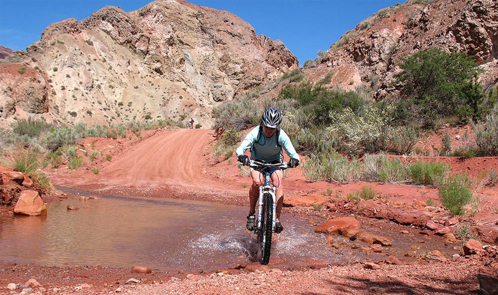
Mountain bike 152 miles on the world-famous Kokopelli Trail from Grand Junction to Moab on singletrack trails and jeep roads through flowering desert canyons along the beautiful Colorado River. COPMOBA built the Kokopelli Trail over 30 years ago, and has been offering a guided ride every May as a fundraiser for the nonprofit, learn more about our Annual Guided Kokopelli Tour.
Details coming soon!
Photo by Joey Early
The Ribbon info coming soon!
Details coming soon!
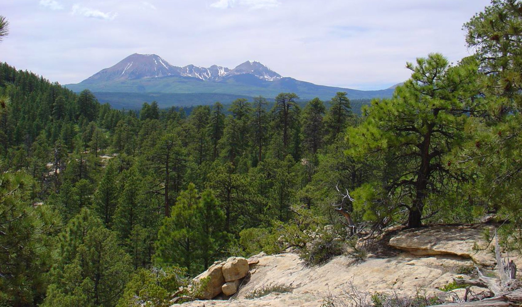
On the Whole Uncolada you ride the Plateau from top to bottom, 3,700 feet of descending bliss from the Aspen forest and to the finish at Buzzard Gulch. Be prepared for the Spring Creek crossing, and some steep descending.
Coming soon!
Seasonal closure from December 1 through May 1 annually.
The Palisade Plunge connects the top of the Grand Mesa (10,700′) to the Town of Palisade, CO, (4,700′) and offers 32 miles of singletrack. This challenging trail offers a steep and technical ride, with a mix of rocky sections, tight turns, and fast flowy sections. For those that take “the plunge” the trail provides an unforgettable experience, with stunning views of the surrounding vineyards, orchards, and the Colorado River. The trail is a must-ride for any advanced mountain biker visiting Western Colorado.
Learn more about the Palisade Plunge.
Coming soon!
Connecting the Tabeguache & Kokopelli Trails
The Paradox Trail was established in 1995 by COPMOBA in collaboration with Montrose West Recreation, the US Forest Service, and the Bureau of Land Management. The 110 mile long Paradox Trail traverses the unique landscape of Western Montrose County, utilizing some of the hundreds of miles of back country jeep roads and trails that exist in this area. The route links two other long distant trails in the region, the Tabeguache Trail to the east on the Uncompahgre Plateau and the Kokopelli Trail to the west in the La Sal Mountains of Utah. Together, the three trails form the “Grand Loop”, a grueling 360 mile back country system sure to challenge the strongest mountain bikers.
The Paradox forms the southern leg of the Grand Loop, and even though no singletrack was created (as of 2011) for the trail, the area offers trail users some of the most rugged and remote backcountry terrain in the lower 48. There are six large tracks of public lands being administered as wilderness in the region, and while the trail is predominantly on two-track, don’t be fooled thinking this is an easy or fast ride. Riders continually underestimate the trail’s ungroomed and ever changing conditions at altitudes that range from 9,500 feet on the Uncompaghre Plateau to the warmer lower elevations ( 4,800 ft.) along the Dolores River. Many of the old jeep trails used for the Paradox Trail were long abandoned and overgrown when designated for the trail. Some areas qualify as singletrack because of the trail width and there are a least five “hike-a-bike” sections to be negotiated. While there are trail sections that utilize some seasonally graded county roads, much of the Paradox Trail is inaccessible to motorized vehicles although vehicle access points exist at many places. Caution should be used during wet weather conditions as all back country roads can become slick, soft and impassable. The trail is marked at key intersections and throughout the route with brown carsonite signs.
Riders need to be cautious and personally responsible when in the backcountry. The use of topographical maps and or a GPS is strongly recommended. Wildlife abounds with elk, mountain lion, coyotes and rattlesnakes. It is not uncommon to encounter bears in some sections. There is world class hunting in the West End so riders should familiarize themselves with the various seasons and wear orange during rifle seasons. Water is found in many drainages and should always be treated. With the new rerouting of the trail scheduled for 2012, riders will have access to services in Nucla, the only source of supplies along the entire Grand Loop. Trail users can find the Paradox Trail on the BLM Nucla, La Sal and Moab Section maps.
Undeveloped campsites exist at Pinto Mesa, Tabeguache Creek, Upper Spring Creek Mesa, Mesa Creek and Biscuit Rock. There are established National Forest campgrounds at Buckeye Reservoir in the La Sal Mountains, Columbine and Antone Springs Campgrounds on the Uncompahgre Plateau and the BLM Dolores River takeout upstream from Bedrock. All camps are accessible by two-wheel drive vehicles.
Photo by Nick Patrick / Yeti Nest Films
The Grand Loop info coming soon!
Coming soon!